Types of Maps We Create
We create custom maps across industries for building complexes and indoor spaces.

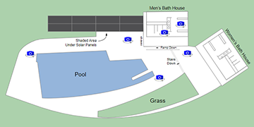
Facility Maps
We create facility maps for all types and sizes of facilities including health, hospitality, education, manufacturing, and transportation. We tailor your maps to a variety of needs including wayfinding, operations management, fire-life safety, security, accessibility, emergency, and strategic planning.
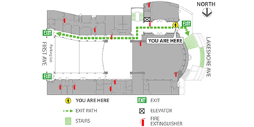
Evacuation Maps
Many cities require public and private facilities to have evacuation plans posted prominently throughout a facility showing occupants how to exit a building safely and other information they may need in an emergency. We develop professional evacuation plans and ensure they comply with local fire codes and match your facility's aesthetics.
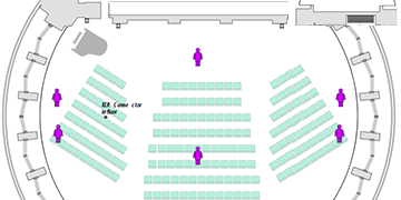
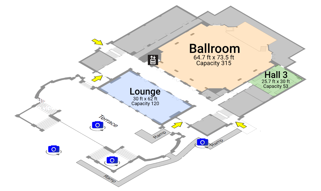
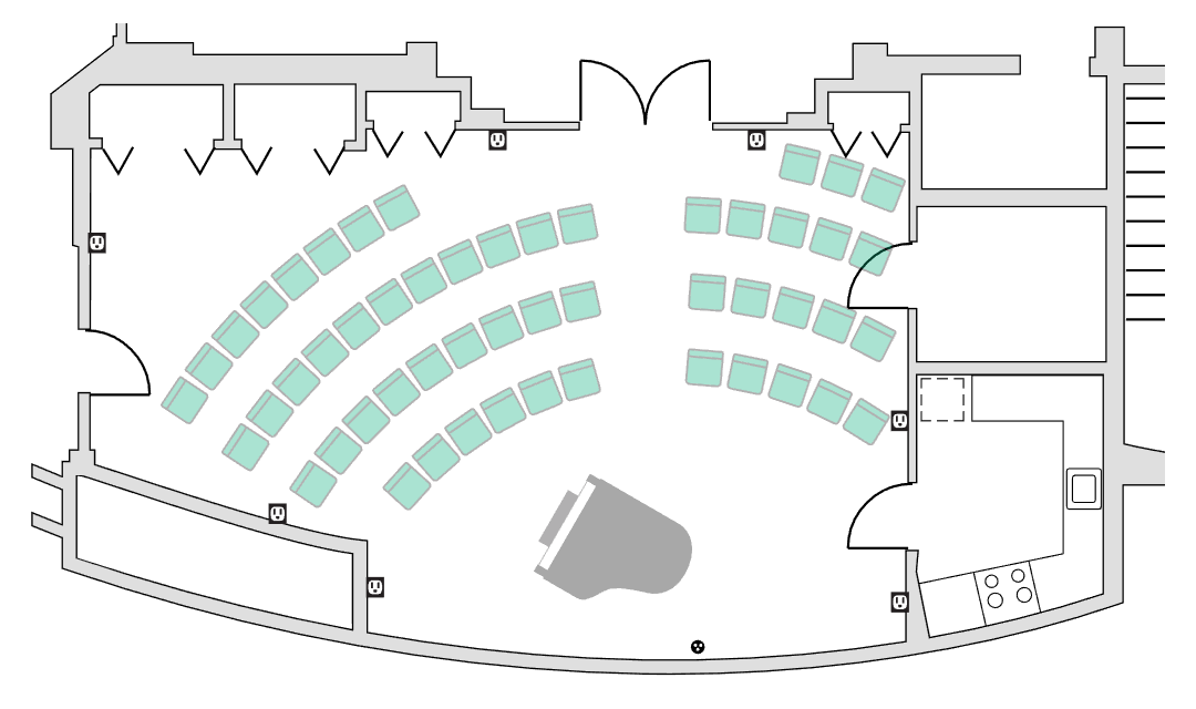
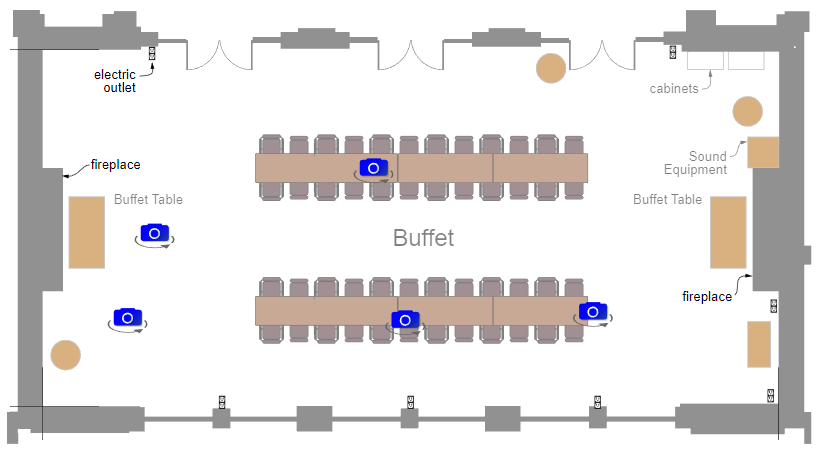
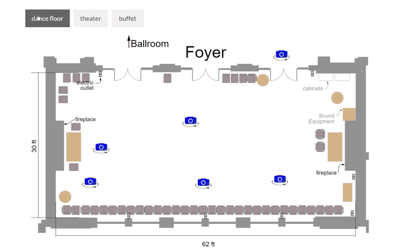
Venue Floor Plans
From wedding reception sites to conference centers, show potential clients everything they need to see to determine if your venue is right for them. Our interactive maps give users the ability to easily and intuitively tour a venue, see 360 degree photos and view different room layouts.
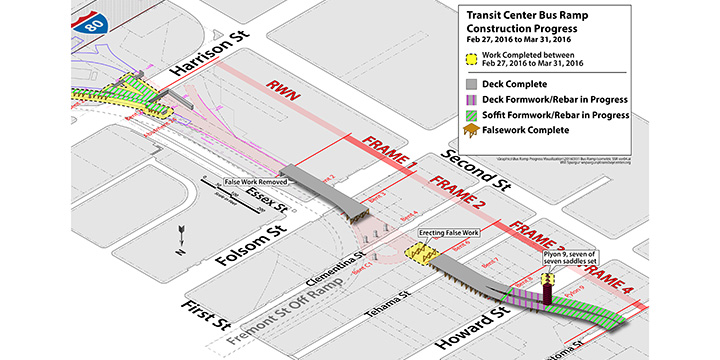
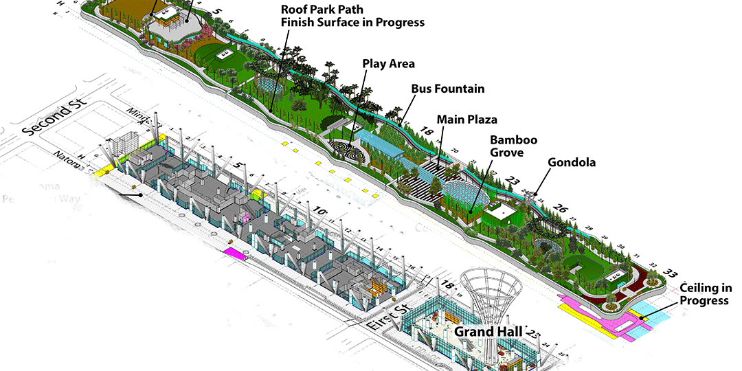
Construction Progress Diagrams
We provide a variety of diagrams useful for the construction industry such construction progress diagrams, road closure coordination, laydown planning and construction sequencing. Coordinate and plan work between contractors, track progress, obtain approvals and permits and, use in presentations to clients and stakeholders. We can also make our maps interactive adding 360 degree panoramas, incorporating data layers for construction progress on a building or tracking repairs and maintenance for a facility.
Campus Maps
We map indoor and outdoor spaces for campuses with multiple buildings. Our interactive maps allow visitors to drill down from a bird's eye view of a campus to individual rooms in a building, complete with 360 degree panoramic photos.
3D Mapping
Clearly illustrate spatial information in all directions. Show more information than a flat map can provide: relationships between levels of a facility, sizes and shapes of buildings, topography of a campus or more realistic representations to aid in wayfinding.
Available Formats
Select the map delivery format that meets your needs. We create the custom maps and
host them online, deliver in static, 2D formats for print and signage, make them
interactive with 360 degree photos or provide tools to integrate
them into
your existing management system.
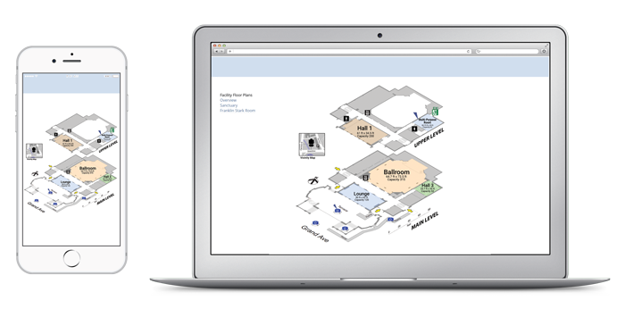
Interactive, Online
Link to your maps on custom-branded, hosted web pages or embed them into your website. Access your maps from mobile devices. Our maps, with embedded layers for layouts or data, as well as 360 degree panorama photos, function across a variety of devices:
 Desktop/Laptops
 Mobile Phones
 Tablets
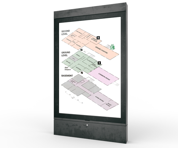
Static
For displaying in print, via signage, presentations, or on static digital screens, Aiambiq provides custom maps in various, high-resolution vector formats, such Illustrator, PNG or PDF, so that they can be printed at the highest quality or displayed in large format displays.
Integrations
Aiambiq interactive maps can be integrated into existing facility management or database systems.
"We've been working with Aiambiq since early 2017. They created a beautiful rendering of our space complete with 360 views inside each room. This has been an invaluable tool for us to promote our theaters and restaurant to partners and potential renters. Plus their staff is a joy to work with. Highly recommended!"
- Duncan Wold, Operation Director at PianoFight
(multi-stage venue and restaurant, downtown San Francisco)
Interested in Learning More?
Connect with us to discuss
how we can help you show off your space with interactive floor plans: